_
Accessible walks in Pembrokeshire
Walking is a great way to explore Pembrokeshire, and this includes wheelchair walks.
Gentle strolls and wheelchair access walks, perfect for families with pushchairs too, are available right across Pembrokeshire.
Here are some of the best accessible walks in Pembrokeshire
- Park: Disabled parking outside Wildlife Centre building
- Walk: 3km wheelchair walk to Old Cardigan Bridge
- Toilet: Accessible toilets ground floor in centre.
- Café: Access to Glasshouse Café by lift (seasonal)
Every season has its place at this wonderful wildlife centre and there is always something going on either in the centre or out in the wetland reserve. Come watch huge flocks of wintering birds, check out the latest willow sculptures, set the kids loose in the outdoor playground or enjoy a cup of tea in the magnificent Glasshouse café. If you’re looking for a space that will have something for all the family this is it.
There are two accessible walkways through the wildlife area, one of which is the wonderful 3km trail through the Teifi Marshes to Cardigan Old Bridge. Remember to bring your binoculars and bird watching book.
- Park: Llys y Fran car park
- Walk: 2.4km wheelchair walk on Eastern reservoir
- Toilet: Accessible toilets adjacent to car park
- Café: Accessible cafe at Llys-y-Fran centre (seasonal)
Llys-y-Frân is a 350 acre country park set in the heart of the Pembrokeshire countryside. The main focus of the park is its reservoir and its dramatic 100 foot high dam that sends water crashing down into the River Syfynwy. The park is a haven of peace and tranquillity, with a great variety of trees and wildlife, both on and off the water.
From the car park there is a 2.4km trail around the eastern side of the reservoir, most suitable for wheelchair access, with a children’s playground and plenty of picnic spots to stop and admire the view. Retrace your steps once the path narrows. The path then continues round the reservoir crosses a bridge and becomes more narrow and muddy, with steep gradients in places.
- Park: Car park at Stackpole Walled Mencap Gardens
- Walk: 3.8km return wheelchair walk signposted ‘Grassy Bridge’
- Toilet: Accessible toilet at Stackpole Walled Mencap Gardens
- Café: Accessible café at Stackpole Walled Mencap Gardens (seasonal)
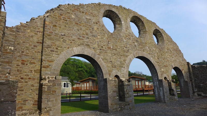
The National Trust woodlands on the Stackpole Estate have been developed to offer a wealth of accessible trails in this beautiful corner of Pembrokeshire.
Park at the Mencap walled garden and head down the road onto the 8-Arch bridge and Bosherston Lily Pond walk. Walking along the ponds you will see a wealth of wildlife, including friendly robins and maybe an otter. The Grassy Bridge is your destination or you can also walk further, although it gets sandy, to a seat overlooking Broadhaven beach. Shady in the summer, sheltered in the winter.
- Park: Blackpool Mill
- Walk: 300m wheelchair walk signposted ‘Leat Walk’
- Toilet: Nearest accessible toilets in Narberth
- Café: Blackpool Mill with outside seating (seasonal)
Canaston Woods are beautiful any time of the year. This ancient woodland has been in existence for at least 300 years and was originally part of the Slebech Estate. The woods have a wealth of history and were once used for hunting deer and wild boar. Foxes and wild squirrels are the biggest animals you will now see in the woods, which are abundant with birds, insects and wild flowers alongside the forest tracks and paths.
The Leat walk is a short, 300m accessible trail through the woods from Blackpool Mill to a viewing area overlooking the Eastern Cleddau river. What it lacks in distance it more than makes up for in scenery and wildlife. A good place to sit and enjoy the silence.
Brunel Trail, Neyland
- Park: Car park at Westfiled Pill, under bridge
- Walk: 6km wheelchair walk, signposted ‘Celtic Trail Route 4’
- Toilet: Accessible toilets in Neyland Marina
- Café: Café at Neyland Marina
There is a little gem of a walk out of Neyland marina to Johnston. Originally a railway, used as the western terminus for Isambard Kingdom Brunel’s Great Western Railway, it has been given a new lease of life as a cycle route, forming part of the Celtic Trail Route 4.
You will need to pass through two ‘A’ frames gates near the start of your walk and then you have a clear stretch of tarmac path, gentle gradients and woodland scenery to Johnston. It’s a fantastic route for everyone.
Saundersfoot to Stepaside
- Park: Saundersfoot Harbour
- Walk: 3km wheelchair walk to Wiseman’s Bridge (4km return to Stepaside)
- Toilet: Accessible toilets at Harbour and Regency Car Parks
- Café: Saundersfoot has many cafes in and around the town, lots with outside seating.
Discover amazing walks in Pembrokeshire with your Dog by clicking here
This lovely coastal path follows the old railway line that used to carry coal from the local mines to Saundersfoot harbour. You can park in Saundersfoot and make your way along The Strand and through the tunnel to Coppit Hall car park.
The trail passes through two tunnels, one short, one long, just before Wiseman’s Bridge, so remember to bring a torch to light your way.
At Wiseman’s Bridge you can extend your walk by crossing the road, by the toilets, to access a new path up Pleasant Valley to Stepaside Ironworks. A lovely up and back through woodland if you want to extend your walk to a 4km return. Pembrokeshire
Pembrokeshire
Disabled Access, Wheelchair walks, Easy Access, Access for All, Mobility, Walks on Wheels, Miles without Stiles – whatever the term the following is all about accessibility to the countryside and green spaces of Pembrokeshire
Walks Greenspaces and Countryside
Angle Bay to Popton Point (Rhoscrowther) – A full size road in good condition with occassioal traffic. The soutern section has gradientsleass than 1:250, the middle section is a bit steeper – 1.6 km
Angle to Old Point House Pub – There is limited parking at the start beside picnic tables. Gradients within BTCFA standards, but the surface can be potholed – 750 metres
Blue Lagoon ( Abereiddi) – Part concrete, part hard earth and rock path. Blue Lagoon is quite a stunning feature – a deep quarry flooded by the sea – 300 metres
Bosherton Ponds ( Stackpole) – Access to site via Home Fram, Stackpole. There are views of ponds, and access as far as Broad Haven beach. – 1.8 km
Carew Castle, Millpond – A stone path now bound with cement, the gradients are to BTCFA standard although it is not a steep path, the crossfall is negligible, and there are seats along the path. 450 metres
Castle Hill ( Tenby) – This tarmac path is on the cliffs overlooking Carmarthen Bay and is quite steep in places, it may be too steep to get right around for those without help. 400 metres
Cwm yr Eglwys to Pwllgwaelod – Purpose built concrete path with frequent seats along the route. There are good sea views at each end. 1 km
Dale Airfield – One of the airfields built for the invasion of Europe. Flat concrete and asphalt flat surface with some bumps 1.3 km
Dramway, Wiseman’s Bridge towards Saundersfoot Harbour – This is an old tramway, in effect a promenade on a sea wall.This path has been surfaced as a cycle track – 3m wide asphalt, the cross fall is negligible, and as this was a railway line initially horse-powered there is no obvious gradient at all. 1225 metres
Goodwick Parrog – east (Fishguard) – Purpose built wheelchair suitable ’stone’ paved path, there is no discernible gradient or cross fall, and seats and interpretation boards are provided along the path – 400 metres
Goodwick Parrog – west (Fishguard) – Part pavement, part brick surface, there is no discernible gradient or cross fall. 700metres
Green Bridge ( Stack Rocks) – Path starts at large car park. Grass path (short turf)on limestone cliff to viewing platform to see Green Bridge of Wales at natural arch – 300 metres
Haroldston Chins ( Broad Haven) – A stone path now bound with cement, the cross fall is neglible. The last 20 metres is no steeper than 1:12, and the rest of the path is no steeper than 1:20 – 370 metres
Haverfordwest – Race Course – The Northern half of racecourse path has inner tarmac path suitable for wheelchairs and prams.
Lodge Park Wood – This estate is run by the National Trust and has a number of assets including two paths, a leisure activity centre with specialised disabled accommodation, Mencap garden shop and a cafe(seasonal) – 350 metres +
Lydstep Head – This is a mostly grass path, but because of the grazing (rabbits, sheep, horses) and the thin soil on limestone, the grass is usually very short. 400 metres
Lyndsway Bay (St Ishmaels) – A new project that focuses on removing obstructions to chairs but does not provide a special surface, therefore the surface is grass. 400 metres
Marine Walk – East (Fishguard) A tarmac promenade with seats starting form the Skirmisher car park. Views across to the old port. 220 metres
Marine Walk – West (Fishguard) This path starts off as a paved walk, some uneven and wobbly, then becomes an old tarmac strip path, but is rough in places. 220 metres
Minwear Forest Walk – Minwear Forest Walk can be started from Minwear Picnic Site in Minwear. – 1 1/2 miles
Newport Parrog to Iron Bridge – This path is purpose built rolled stone path, with seats provided along the way. The surface of this path suffers in the winter from flooding on occasions, 1.1 km
Newport Parrog to Lifeboat Station – This route includes a short paved raised causeway, and also goes along a section of the beach with hard sand/rocks. Most of the length of the path is on an access road, and there are many seats along the way – 700 metres
Newport Sands to Iron Bridge – Path crosses grass golf course and then rolled stone. There is a long sandy beach at the north end with a big car park (charge applicable during summer months) 1.4 km
Pembroke Castle – This is a tarmac path with gradients to BTCFA standards although it is not a steep path and the crossfall is negligible. 600 metres
Pembrokeshire Coast National Park (Walks for all) – Some walks have been surfaced to provide access for wheelchairs, others are footpaths or bridleways where the natural surface has not been changed. As a general guide, we have divided the walks into ‘Easy Access Walks’ and ‘Adventure Walks’.
Penally Station to South Beach – Start of the path is at the railway station, which has accessible toilet close by. The path is a tarmac strip which terminates at an oak viewpoint.
Scooting Around in Pembrokeshire – “A guide to accessible “walks” in Pembrokeshire produced by the Pembrokeshire access group. These routes are well within the capacity of most electric scooters and some are accessible by manual wheelchairs with assistance.”
Skrinkle Haven ( Manorbier) – This site was part of an MOD missile testing range, now owned by the National Park Authority. The route follows the tarmac road and concrete test sites. 600 metres
Solva Quayside – The path is along the promenade, and is part smooth stone track and part asphalt on sea wall. 800 metres
St Davids Airfield – One of the airfields built during the Second World War, declared surplus in the 1980s. The National Park acquired it and manages it for nature conservation and quiet enjoyment. Flat concrete and asphalt surface with some bump 2.4km
St Govan’s Head – This is a tarmac private road with gradients to BTCFA standards although it is not a steep path, the crossfall is negligible. – 900 metres
Stacks Rock to St Govan’s – This is a serious length of path which is effectively a road with various surfaces -part tarmac, part rough stone track and part beaten earth. – 4.5 km
Stepaside Ironworks Circular Walk – This is a short walk over tarmac, multi-user path, gravel and grassy paths – the latter are quite steep.
The Gann – Access along a spit of land that separates saltwater lagoons from the estuary. The lagoons were the source for the aggregate for the concrete used to make Dale Airfield. 250 metres
The Point Path (Little Haven) – The path is of a brick type surface. The gradients are to BTCFA standards and crossfall is neglible. There are seats provided along the path. – 300 metres
Walks for All – Pembrokeshire Coast National Park – Some walks have been surfaced to provide access for wheelchairs, others are footpaths or bridleways where the natural surface has not been changed. As a general guide, we have divided the walks into ‘Easy Access Walks’ and ‘Adventure Walks’.
Wiseman’s Bridge to Amroth Old Road – This is a sealed surface cycletrack about 3m wide with no cross falls. 750 metres
Country Parks
Llys y Fran Reservoir & Country Park – A disabled accessible trail is now open within the wooded area south of the Stilling Basin – also see this Welsh Water leaflet
Scolton Manor Country Park – Green Flad Award – (ACE note – we have been unable to find any accessibility info for this site please contact us with any access info.)
Nature Reserves
Corsydd Llangloffan NNR – An accessible boardwalk runs for a kilometre along a circular route through the reserve, direct from the roadside gate.
Stackpole NNR – 1.5km of wheelchair accessible lakeside path, which links both the National Trust’s Stackpole Centre and the site of the former Stackpole Court to Broadhaven Beach.
The Welsh Wildlife Centre – accessible toilets, cafe. “The easy trail around the site makes it easy for people to access. All the trails have varying levels of access and a map of the trail is available from the reception”
Beaches in Pembrokeshire
Aberbach – it means little river mouth – is a relatively narrow cove with a steeply shelving pebble bank facing due west towards the Irish Sea, reached by road from Mathry, just off the St Davids to Goodwick A487 road.
The visitor to the little fishing village of Abercastle, on Pembrokeshire’s north-western coast, might be excused for thinking they are in Cornwall or Devon, for this hidden harbour beneath the ancient grey igneous rocks is redolent of those areas.
The bank of black slate on Abereiddy beach, and a row of quaint small cottages are reminders of Abereiddi’s hey-day as a slate quarrying area. The cottages were built to house the quarrymen, for the place was humming with activity when the slate quarries on Trwyncastell (Castle Nose) and the granite quarries at Penclegyr were operating.
Aberfelin is a quiet and quaint little cove near the village of Trefin on the north Pembrokeshire Coast. The name means Mill Estuary or estuary of the millstream and the mill at Trefin is celebrated in Welsh poetry.
Abermawr beach, which looks out towards the north-west on the rugged northern coast of Pembrokeshire, is a wide, sandy beach in summer time, but often in winter it is rather bare after stormy weather has stripped away the sand.
Aberwest is a little known sandy cove tucked under the armpit of Dinas Fawr peninsula to the east of Solva on the northern side of St Bride’s Bay. It is not easy to get to, accessible only from the National Park Coastal Footpath either from Solva to the west or from Penycwm or Newgale to the east.
At low-water at Albion Sands, near Marloes Beach on the southern tip of St Bride’s Bay, a head-high piece of metal stand like a statue in the golden sand. Other lower pieces of wreckage protrude from the beach, for this was the spot where the packet paddle steamer after which the beach was named came to a sticky end.
On the boundary of Pembrokeshire and Carmarthenshire, the village of Amroth is tranquil and picturesque in the summertime, with its broad beach looking south towards Tenby, Caldey Island and distant Gower.
Angle Bay gets its name from the Norsemen who found it a useful place to shelter in stormy weather, for the word means an angular corner or nook into a safe anchorage.
A Blue Flag beach, in 2004 Barafundle Bay was listed as one of the Top 12 beaches in the world. In 2006 The Good Holiday Guide described it as “the best beach in Britain” and In 2012 it won the accolade “The UK’s Top Picnic Spot.”
Broad Haven North beach, in the centre of the wide embrace of St Bride’s Bay, although generally calm, can provide good surfing, windsurfing and sailing and has the advantage of being a Blue Flag beach, renowned for its clean condition.
Broad Haven South is a lovely, sandy cove flanked by the 180-mile long Pembrokeshire coastal footpath, attracting film-makers as a picturesque, unspoiled location.
Just round the headland to the east of Caerfai Bay, near St Davids, is the little rocky cove of Caerbwdi Bay, where a stream emerges from the valley once owned by the celtic heathen druid and chieftain Boia.
Just a short walk south-west from St Davids, Caerfai is a sheltered cove facing south across St Brides Bay, which presents a pleasant crescent of golden sands at low tide where children can bathe or explore the rock pools in safety.
Ceibwr Bay is a little notch in the north-westerly facing coast between Newport Head and Cemaes Head where geologists find a whole medley of interesting features and where the high cliffs of this stretch of rugged coast are wild and beautiful, famed for wild flowers and seabirds.
Charmingly-named Church Doors Cove, on the south Pembrokeshire Coast near Manorbier, is so-called because two high arched caves in the sandstone cliffs so much resemble the doorways of a church.
Conigar Pit is a little known rocky and sandy cove tucked behind Old Castle Head near Manorbier. At low tide it is a wide stretch of beach at the western end of which is situated the little cove called Presipe, which has become a happy hunting ground for people who collect fossils.
Coppet Hall is situated on the northern end of Saundersfoot Beach and that corner of the village’s golden sands is known locally as Coppet Hall beach. Here, the 170-mile-long Pembrokeshire National Park Coastal Footpath takes a rather unusual route through a tunnel from two former horizontal mineshafts or adits towards the coastal villages of Wiseman’s Bridge and Amroth.
The remains of a storm-wrecked seaside church, standing stark and dramatic like part of a film set or TV scenario, give Cwm-yr-Eglwys (Church Valley) in North Pembrokeshire its name.
If sunshine is the aim then Dale on the far west coast of Pembrokeshire is the place to be. This charming little seaside village, sheltering inside the northern entrance to Milford Haven harbour has the enviable record of enjoying more sunshine hours than most other resorts in the UK.
Deadmans Bay is an almost inaccessible rocky cove on the southern tip of the Marloes peninsula and its westernmost headland, The Deer Park, which juts out into treacherous Jack Sound towards Midland Island and Skomer.
Drinkim is one of Caldey Island’s galaxy of exotically named bays and beaches however, on the eastern side of the Island facing out across Carmarthen Bay. Where it got its name is a puzzle which locals seem unable nowadays to explain.
Druidston Haven, in the centre of St Bride’s Bay, has an air of mystery about it. When the tide is in, its beautiful golden sands can’t be seen from the road, but its charm unfolds as the visitor descends the steep path down into the cove.
East Angle Bay on the southern shore of Milford Haven Waterway has its own micro-climate. Sheltered round the corner from the full force of the Atlantic gales and swells which frequently batter the entrance, Angle is amongst the warmest and sunniest places in the country.
Flimston Bay is quite a suntrap, facing due south under the Castlemartin Cliffs which shelter it from all but the warm southerly winds. The area is so full of geological phenomena that the name Flimston features prominently in every geographer’s textbooks and study files and is a ‘must do’ among the student tickboxes.
Its wide sandy beach and south-eastern aspect make Freshwater East an ideal resort for family bathing, with deep golden sand and a sheltering backcloth of dunes. In hot summer weather it is a veritable suntrap and the waves are gentle and toddler-friendly when the weather is calm.
Freshwest, as it called locally, is one of Wales’s top surfing beaches and the base of surf schools offering surfing lessons for adults and youngsters, instructor courses and lifeguarding awards. It is also a commemoration site for one of the worst sea tragedies off this coast during World War II.
Gelliswick is one of those many places around the Pembrokeshire coast which got its name from the marauding Vikings. Vik, as also in the names Goodwick and Musselwick, means harbour in the Norse language, but who or what Gelli or Gelly was the historians seems wary about speculating.
Before the harbour and the railway were built in 1906 with the intention of accommodating trans-Atlantic liners in competition with Liverpool and Southampton, Goodwick was just a small village with only a few houses and a fishing quay on the more sheltered side of the bay.
A wide, sandy beach less than a mile south of the village of St Ishmaels on the northern shore of the Milford Haven Waterway. Lindsway Bay is a pleasant bathing place for families, as the Royal family can confirm.
Little Haven is a small cove into which the roads from three directions drop steeply to the water’s edge. Tucked under the cliffs, its main street passing through the valley parallel with the little stream which runs out over the beach into St Brides Bay.
Lower Fishguard, also known as Lower Town to the locals, is the old historic trading and fishing port which served Fishguard Bay before the present day Ferryport at Goodwick was built across the Bay in 1906.
Lydstep Haven on the south Pembrokeshire coast between Lydstep Point and Proud Giltar head, is a beautiful crescent-shaped bay with a fine stretch of golden sand facing east towards Caldey Island.
With its magnificent cliff-top castle and historic Norman church, Manorbier on Pembrokeshire’s south coast five miles west of Tenby has much to offer tourists with an interest in the past as well as visitors who love the seaside.
Marloes Sands, round the southern tip of broad St Brides Bay is a wide, curved stretch of golden sand between Hooper’s Point and Gateholm Island. Although it is a bit of a walk from the nearest carparks at Marloes Mere, Martin’s Haven and West Dale, those who frequent it think it well worth the effort.
The stumps of 4,000-year-old trees make an appearance every few years at Marros Sands, near Amroth, when low tides and rough seas scour away the mud and sand to reveal the petrified forest. It holds pride of place for the clearest example as the stumps and roots of oak, alder and willow are better preserved here than anywhere else in Pembrokeshire.
It is a good idea either to get to Martin’s Haven early enough to view some of the mainland’s interesting features, or to linger after returning from Skomer to stroll over to the western tip of the Deer Park or round the headland to the east for a couple of hundred yards.
A stone arch over the path leading down to the shingly beach of Monk Haven, on the northern shore of Milford Haven Waterway near St Ishmaels gives the place an air of mystery which has appealed to artists over the years. The beach looks south towards the harbour entrance, with Dale Fort on the right and the tip of the Angle peninsula and Thorn Island to the left.
Two miles north of Tenby, Monkstone Point marks the end of Tenby Roads and the beginning of Saundersfoot Bay. Looking down on them from the coastal footpath at low tide Monkstone Sands look very inviting, and so they are, for the bathing is safe, the rockpools abundant and the space ample for recreation.
Musselwick Sands, not to be confused with the inaccessible rocky shore of the same name beneath beetling cliffs near Talbenny, is a sandy strip near the village of Marloes. Facing north into St Bride’s Bay it is located midway between Wooltack Point and Nab Head.
The breathtaking vista of St Brides Bay as you drop down into Newgale is something you aren’t likely to forget. With the northern end of Skomer island to the left and to the right the rugged coast meandering round past the Green Scar rock off Solva to the northern extremity of the Bay, where Ramsey Island and the South Bishop Rock peep round the corner of St Davids Head.
Part of the Nevern Estuary, Newport Parrog beach is sandy at low water but rather stony when the tide is up. It is safe for bathing in calm weather at high water but dangerous currents make it treacherous around the ebb tide.
It is the proud boast in North Pembrokeshire that the beautiful golden crescent of Newport Sands is the finest beach on that seaboard. It is known by its Welsh name ‘Traeth Mawr’ (Big Beach) to distinguish it from other beaches in the area, particularly Parrog beach
Nolton Haven Beach
Nolton Haven is a small, sheltered cove with a nice sandy beach, right beside the coast road between Broad Haven and Newgale. From the top of the beach, only yards from the road, one is struck by the outlines of the two headlands which close the narrow bay, for they resemble faces looking across the beach at each other.
Penally beach is actually an extremity of Tenby’s South beach rather than a beach or bay in itself, with dunes at the rear. Behind the dunes at Penally Tenby’s 18-hole Golf course was established and the village has also been the location of an army camp and firing range for many years.
Poppit Sands near St Dogmaels, where the river Teifi flows into the sea after passing through Cardigan, is one of the departure points for a special expedition to see the enchanting dolphins which have been such a source of fascination to man down the ages.
The trading port serving St Davids for many centuries, Porthclais is a sheltered harbour on the south-western tip of the St Davids Peninsula where the River Alun enters the sea.
Porthlleuog is an almost circular rocky cove tucked into the cliffs just east of Strumble Head near Goodwick. It is only a mile or so along the National Park Coastal Footpath west of Carreg Wastad, where there is a memorial stone commemorating the abortive French invasion of Fishguard in February 1797.
Porthlysgi Bay, facing south-west on the southern tip of the St Davids peninsula, is a deep inlet with a rocky beach looking out towards the craggy islet of Carreg yr Esgob (Bishop Rock).
The beautiful sandy cove of Porthmelgan can be seen to best advantage from the 595-foot summit of Carn Llidi, the craggy tor which presides majestically over St Davids Head. Facing south-west, it is tucked into the sheltered crook of St Davids Head at the northern tip of Whitesands Bay.
Porthselau is a little sandy bay at the south end of Whitesands Bay, St Davids, and at low spring tide it is possible to walk from one to the other. Sometimes spelled Porthsele, the beach is sheltered from the south-westerly prevailing winds so there is usually no need for a windbreak, and the sunbathing is good.
Priory Beach is the wide sandy embrace which welcomes visitors to the monastery island of Caldey off Tenby. The landing jetty is right in the centre of the beach, which stretches from Eel point to the Old Quay, and the visitor has only to walk a few yards to sink his feet into the deep, warm golden sand of Priory Beach, which is a veritable seaside lover’s paradise.
Pwllcrochan is an isolated sandy and rocky bay on the north coast between Porthgain and Trefin, but does not appear to justify the name of Cauldronpool or Crockpool. Pwllcrochan North is best approached via the Pembrokeshire Coast National Park Coastal Footpath, either from Porthgain to the west or Trefin to the east.
Pwllgwaelod is one of the starting points for a popular three mile walk along the Pembrokeshire National Park Coastal Footpath around Dinas Head. The Head is also known as Dinas Island because it is separated from the mainland by a deep valley with a stream running through, so the “sound” between them is only a couple of feet wide for most of its one mile length.
Sandtop Bay is one of the lovely sandy bays which make Caldey island off Tenby such a desirable place to visit. Situated on the island’s western shore, it looks out towards Lydstep and Old Castle Head with Stackpole Head and St Govans Head in the distance.
Sandy Haven is a wide estuarial creek entering Milford Haven Waterway on the north shore, midway between Dale and Milford Haven town. At low tide when the stream is reduced to a trickle, it can be crossed by means of the Triple Stone stepping stones on the western side to the long stretch of golden sand on the eastern shore.
Separated by Saddle Point headland from the popular South Pembrokeshire beach of Broad Haven South, Sandy Pit is a narrow beach named after the collapsed blowhole which occupies its north-eastern corner. This geological feature is one of six blowholes along a one mile stretch of this coast, where the soft carboniferous limestone has succumbed to years of erosion by wind, wave and rain and subterranean streams.
Saundersfoot is such a tranquil place in summer weather that it is difficult to understand why its harbour is protected by such stout stone walls. Built like a fortress, built to accommodate far bigger and sturdier boats than the holiday craft which now packs the marina.
The sandy, shingly beach of Skrinkle Haven, between Old Castle Head and Lydstep Point, lies south-east of Manorbier village. It was off limits to the public for many years as it was situated beneath the firing arc of the Royal Artillery Range at Manorbier.
Sleeping Bay is a rocky and rather muddy beach on the western side of Sandy Haven on the northern shore of Milford Haven Waterway. Its name is relatively unknown, except to the locals, as it is only accessible at low tide by wading across Sandy Haven Pill round Sleeping Bay Point near Triple Stones near where the estuary is crossable by way of three slippery stepping stones.
The boomerang-shaped tidal creek at Solva, with its south-facing entrance guarded by high headlands, is arguably the safest harbour around the Pembrokeshire coast. It is steeped in maritime history and during its boom years, in the 18th and 19th centuries, was one of the busiest trading ports in Pembrokeshire.
St Brides Haven is a pretty little rocky cove flanked on its northern side by a low building known as Cliff Cottages, a dwelling so close to the sea that it seems in imminent danger of being swept away by stormy waves.
Swanlake Bay can be accessed only off the Pembrokeshire National Park Coastal Footpath, with no car park nearer than Manorbier, so only the most determined will discover it. That means it is a hidden gem well worth seeking out as it is seldom if ever crowded.
The beautiful resort of Tenby is often described as “The jewel in the Crown” of the Pembrokeshire coast. Its history goes back into the mists of time, its origins possibly an 8th century Norse settlement and a 9th century Welsh stronghold, its name deriving from the Welsh ‘Dinbych-y-Pysgod’ (Little fortress of the fishes).
In contrast to Tenby’s sheltered North Beach, the mile-long stretch of the South Beach, from St Catherine’s Island to Giltar Point, is more exposed, but enjoys a splendid view of Caldey Island to the south.
Traethllyfn is a westerly-facing sandy beach between Porthgain and Abereiddy on Pembrokeshire’s rugged north-western coast. It has a link with the Celtic Christian monks and hermits who frequented this coast so close to the sacred settlement of St Davids.
A shallow crescent-shaped bay with a virtually inaccessible beach of rock and shingle on the north-west facing stretch of coast between St Brides and Mill Haven near Talbenny, Warey Haven is a place that few people are familiar with.
The popular South Pembrokeshire resort of Tenby is blessed by such beautiful beaches that Waterwynch Bay on its northern shore is little frequented despite the magnificent cliff scenery, rising steeply to nearly 300 feet at the triangulation station above North Sands.
If Watwick Bay could tell a story, it would be a tale of stormy seas and shipwrecks, for this rocky shore at the entrance to Milford Haven Waterway has seen innumerable maritime disasters involving coastal sailing vessels, steamers, trawlers and tankers.
West Angle Bay is a small but pleasant beach, safe for bathing, its golden sands protected by rocky outcrops on each side of the entrance. It is a short, level walk from the village, andt here is a spacious car park close to the beach with a cafe and toilets.
The valley that runs from the coast at West Dale Bay to the other side of the Dale Peninsula is of great geological interest. A break in the solid rock of the cliff marks the western end of the Rhaetic (or Ritec fault) system which runs east up the Milford Haven Waterway and through the Ritec Valley at Tenby before crossing under Carmarthen Bay to Gower where it almost separates that peninsula from the South Wales mainland.
A jewel in the crown of North Pembrokeshire, Whitesands Bay, or Porthmawr (Big Harbour) in Welsh, is a large expanse of pale gold sand with Blue Flag status and a reputation as one of the finest surfing beaches in the country.
Wiseman’s Bridge lies midway between Monkstone Point and Telpyn Point in the broad curved sweep of Saundersfoot Bay. Today it is a little village behind a pebble ridge and a broad sandy beach ideal for family outings.
The Castlemartin route is on part of the Pembrokeshire Coast Path National Trail, a 186 mile trail stretching from St Dogmaels in the North to Amroth in the South. This is a unique route in Pembrokeshire as it crosses the Castlemartin Ministry of Defense firing range and because of this, it is closed when the tanks are firing! The path is usually open at weekends and Bank Holidays but please check the live firing times on 01646 662367 before starting this route. If you see red flags flying or red lights are displayed DO NOT ENTER, the range is live!
So what can you expect to see on this route? Plenty. It is a stunning section of coastline so don’t forget your camera. Begin the journey at the Stack Rocks car park and it’s the Green Bridge of Wales that you first see. It’s one of Pembrokeshire’s most famous geological features, formed by the sea cutting through a narrow headland. Stack Rocks are two limestone pillars that used to look like the Green Bridge, now collapsed, they are home to hundreds of guillemots, razorbills and other seas birds during spring and summer.
The remains of Iron Age forts built over 2000 years ago can also be seen along this route. These forts would have looked out over a wooded valley but raising sea levels swamped them to form the Bristol Channel as we know it today. This part of the coastline is also steeped in legend. Huntsman’s leap, a narrow steep-sided inlet formed by erosion along a fault line in the cliff, carries the legend of a huntsman who urged his horse to jump over the chasm. He landed safely but then looked back and dropped dead from shock when he saw what he had jumped over!
St Govan’s Chapel has its origins in the 6th century, with the chapel you see today dating from the 13th century. The hermitage is built in to the face of the cliff and reached by a stone flight of steps. You must take the opportunity to go down to the chapel but as you do count the steps down. Legend has it that when you count them on the way back up the number is never the same!
When you make it to the car park you have reached your destination. If you have packed a picnic head down to the golden sandy beach of Broad Haven south for a well earned break before the return journey or continue a little further along the lanes to Bosherston where a wonderful cream tea can be had in the garden at Ye Olde Worlde cafe.
The bridleway has a stony surface and it is possible to explore the area between the path and the cliffs but on foot. The path follows the cliffs that have sheer drops. For your safety please keep to the path at all times. The path is a popular shared path so please expect to encounter other cyclists and walkers.
Mode: Cycling and walking
Length: 6.3miles (10.1km) one way
Bike hire: Bierspool Cycles, London Road, Pembroke Dock, Tel: 01646 681039 Sales, repairs and service
